Historical Portrait
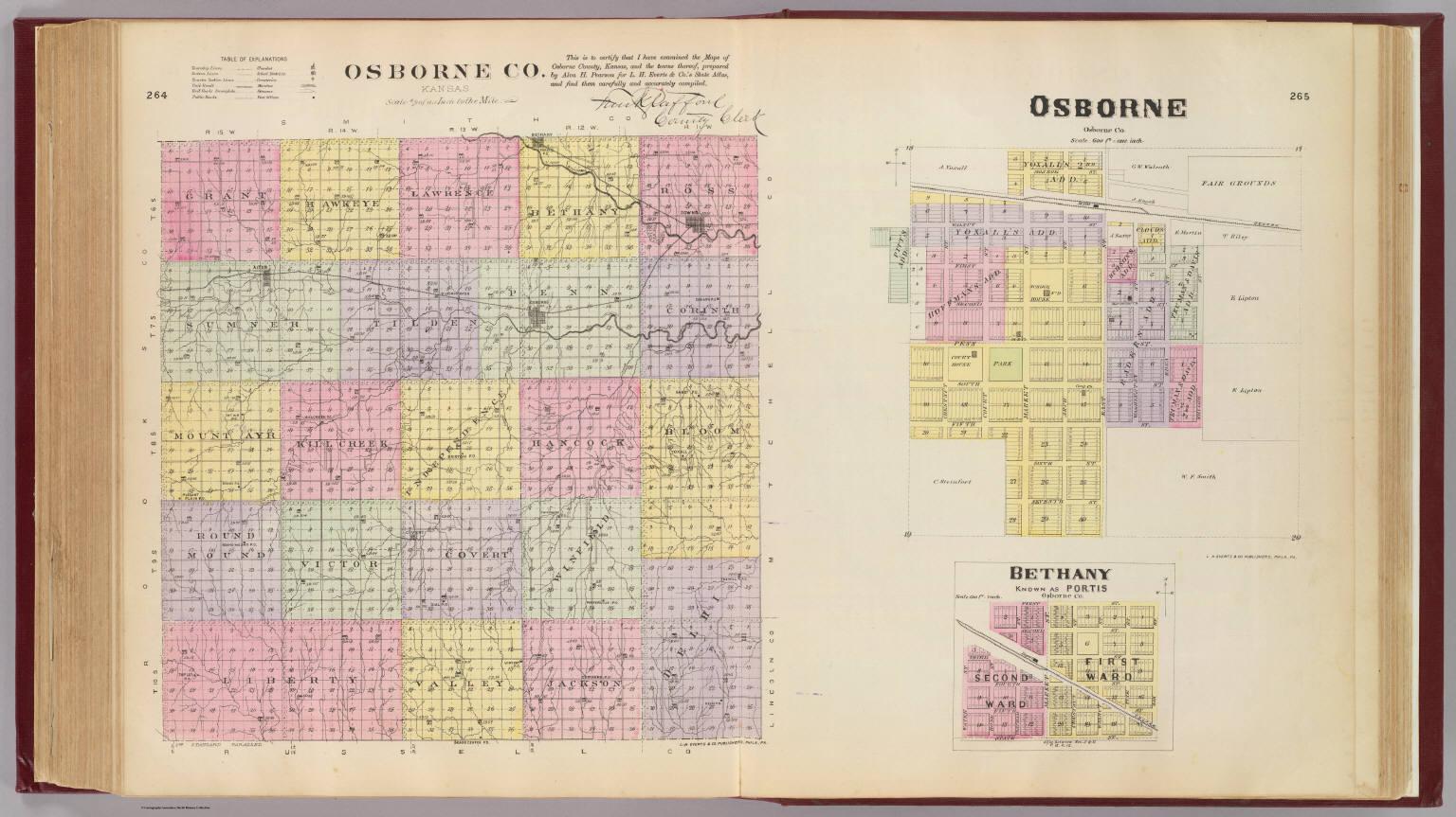
Osborne Co., Kansas. (with) Osborne ... (with) Bethany, known as Portis ... L.H. Everts & Co., publishers, Phila., Pa. (1887)
About this portrait
Public-domain 1887 hand-colored lithographed map of Osborne County, Kansas, showing townships, sections, and city insets of Osborne and Bethany (Portis).
Rights & Attribution
Credit: Internet Archive
Rights: Images may be downloaded and used following Creative Commons CC BY-NC-SA 3.0 license. Image credit should be given to "David Rumsey Map Collection, David Rumsey Map Center, Stanford Libraries." Please contact the David Rumsey Map Collection for commercial use. <a href="https://www.davidrumsey.com/about/copyright-and-permissions" rel="nofollow">https://www.davidrumsey.com/about/copyright-and-permissions</a>